Hunderburton Adventures

|

A record of wanderings through Latin America

Archive for the ‘Andes’ Category

Disaster on the Torres Del Paine!

Saturday, December 31st, 2011

So our attempt at finishing the Torres del Paine circuit was a blazing failure. That was a pun. If you can’t guess why, it will all become clear in time.

Torres del Paine (Towers of Paine – “Paine” I believe means blue in an extinct native language) refers to both the national park and these jutting out “towers” for which the park is famous (and obviously its namesake).

Image from wikipedia of Torres del Paine

I’ll start our story with the relevant history of the park: what we’ve gathered from speaking with locals is that the park started as farm land (albeit primarily unfarmable farmland due to its mountainous situation) and tourists wishing to hike through the land would request shelter, showers and whatnot from the farmers. Tourism increased and the farmers saw potential to capatalise on their situation, and set up serviced huts (called refugios). Most of the park has now been donated to the Chilean government, but parts, including some through which hikers pass, remains private property. The park is now one of Chile’s biggest tourist attractions bringing around 70,000 tourists every summer.

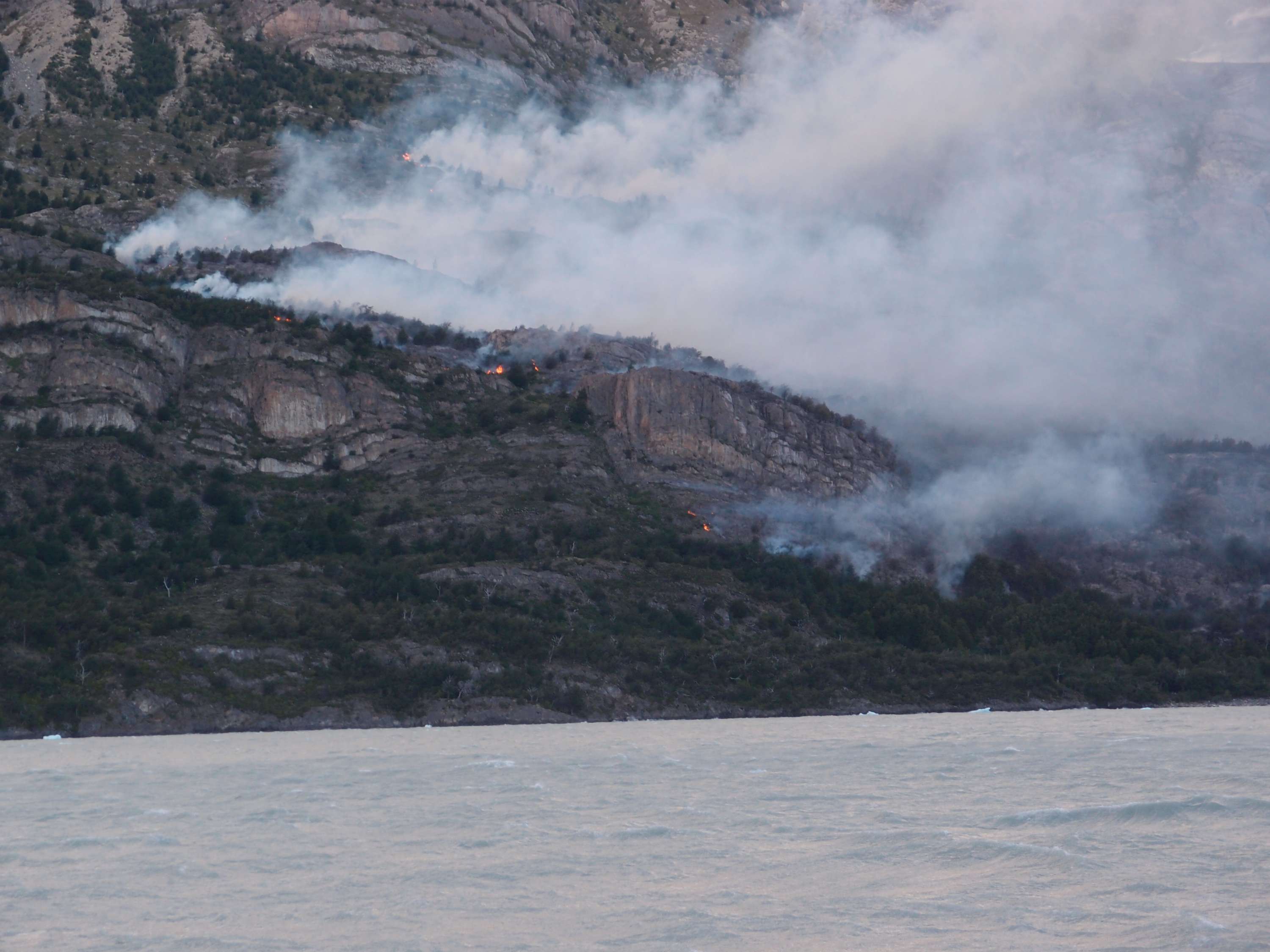
The biggest attractions of the park exist on a 4 day hike but for those wanting to see everything there is a 9 day full circuit (we got greedy and did this one). Okay, so to our adventures: around a week ago we set off for the 9 day circuit through the park. On the 5th day we joined the main tourist  drag, looking forward to seeing the iconic towers and all the other sights the lazy 4 day trekkers come to see. That night, we met a somewhat panicked American couple who told us that they had left their tents for a short day trip to see the nearby glacier, only to find on their return that a wall of fire separated them from their stuff. Later that night the authorities closed the path until the fire could be controlled. The fire blocked our planned route too, so we had no choice but to wait and see what would unfold. On the 6th day the refugio staff informed us we would need to evacuate by the end of the day. The two options available to us were to go back the way we came or to pay for a $70 ferry ride out. The ferry was a tourist boat providing scenic views of the glacier, it was also the only boat  on the glacial lake, and therefore the only evacuation route by water. We had been hiking next to this glacier for the past two days and were not too interested in paying for the privilege of seeing it from a slightly different angle. The ferry ran every few hours but was becoming increasingly late due to its new role evacuating hikers and supplying firefighters with new men and equipment. Even if we wanted to fork out that kind of money for evacuation we couldn’t since the ferries quickly become booked out. So again we had no choice but to wait around the refugio, peering out at the smoke wondering whether it was getting closer (A day later someone told us that it actually did burn down a neighbouring building to our refugio).

Torres del Paine fire from ferry during evacuation

The fire (taken from the ferry)

Later we were informed that even turning back was not an option, as the fire was spreading rapidly, and the entire park was to be closed for an indefinite period. This created the rather bizarre situation, one which could only ever be the result of poorly planned privatization, that we were legally required to leave, which we could only do by paying $70 per person, a price which many hikers don’t have the free cash to cover.

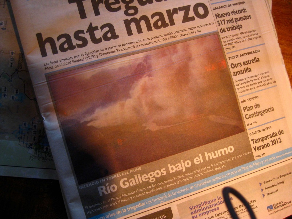
The fire made front page news in Argentina and Chile

We figured if the fire got close enough the Chilean government would be obliged to pay for our evacuation. We didn’t have the highest hopes, however, as we had heard that the emergency response in South America was second-rate; rather than fire fighting vehicles and helicopters, the volunteer fireman only had shovels and buckets. Furthermore, one story recounted by another hiker was of a mountain climber who died during a climb in Argentina. The Argentinian government’s response, either through lack of interest or funds, was to leave the body on the mountainside, and now climbers have the opportunity to see a corpse hanging on the side of a mountain (this may attract more tourists so perhaps is not such a bad move). Anyway, our assumption that Chile would pay for our evacuation may be have been a risky maneuver in order to save $70 but it paid off in the end when the government announced a state of emergency and gave us a free lift back to Puerto Natales (although we arrived at 1 am without a place to stay).

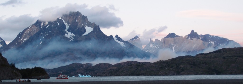
lago grey torres del paine fire evacuated ferry

Fire from afar: you can see the smoke at the base of the mountain and the ferry which rescued us.

So this is the reason we are back in Puerto Natales 3 days premature. The biggest “Paine” of this whole mess is that we missed the main highlights of the trek and probably won’t be back to this remote part of the world for a while.

Our 5 hiking days did however have perfect weather and we have seen things many wouldn’t. The weather was so rare that one park tour guide told us that it hadn’t been this sunny and dry in around 10 years. Usually, we’ve been told, the weather is  really crazy with perhaps sun in the morning, gale force winds by midday and snow by night. Most visitors are still blown away by the park which I guess is the reason for the sustained numbers of visitors (once quite literally, four years ago, when the strong winds in the area actually blew a hiker away. He probably died).

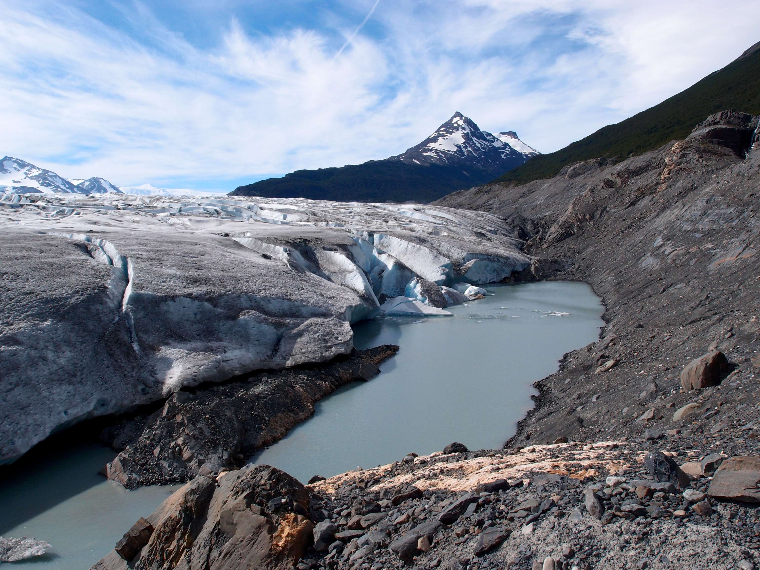
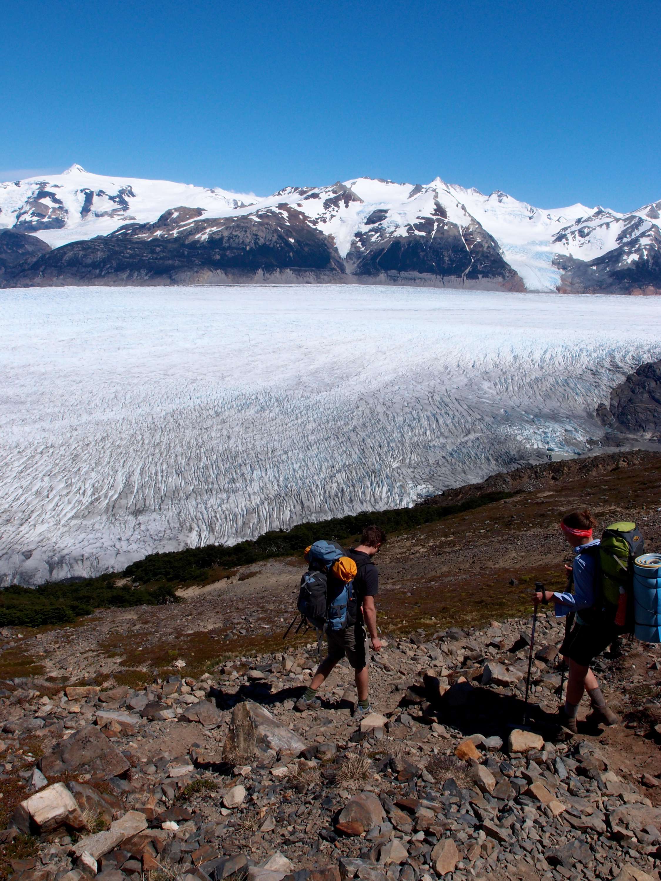
Unfortunately the unusually blue skies and hot sun we experienced were a likely contributing factor to the fire. Despite not seeing everything we still managed to see 3 glaciers. One of which Sven and I managed to get extremely (and probably dangerously) close to during one of our wanderings (there is so much day light in the area that after setting up camp it is easy to check out the area near the campsite). We scrambled down these rocks and ended up at the glacier. I’ve made a strip of pictures to show you the events which transpired:

glacier grey torres del paine

Sven eating glacial ice

I think Sven would like me to mention that that ice could be thousands of years old and also contributed towards shaping the environment we all came hiking to enjoy. If tasting glacial ice allowed one to share this history and to be part of the amazing geological system (which most humans can only humbly observe) and experience just a small amount of the grandness of this landscape, then Sven might be a very wise person… but it doesn’t so he isn’t; he’s just an idiot.

Glacier close up

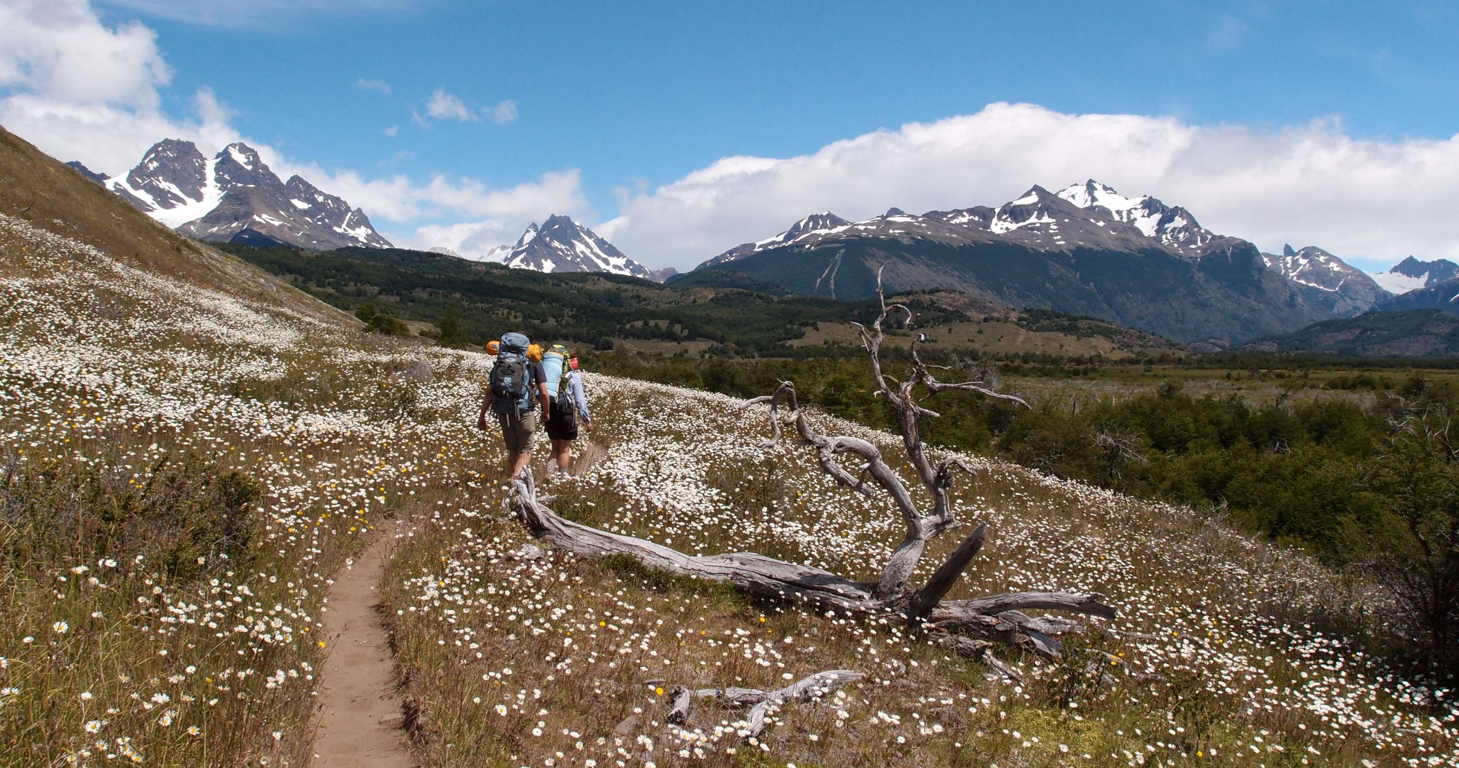
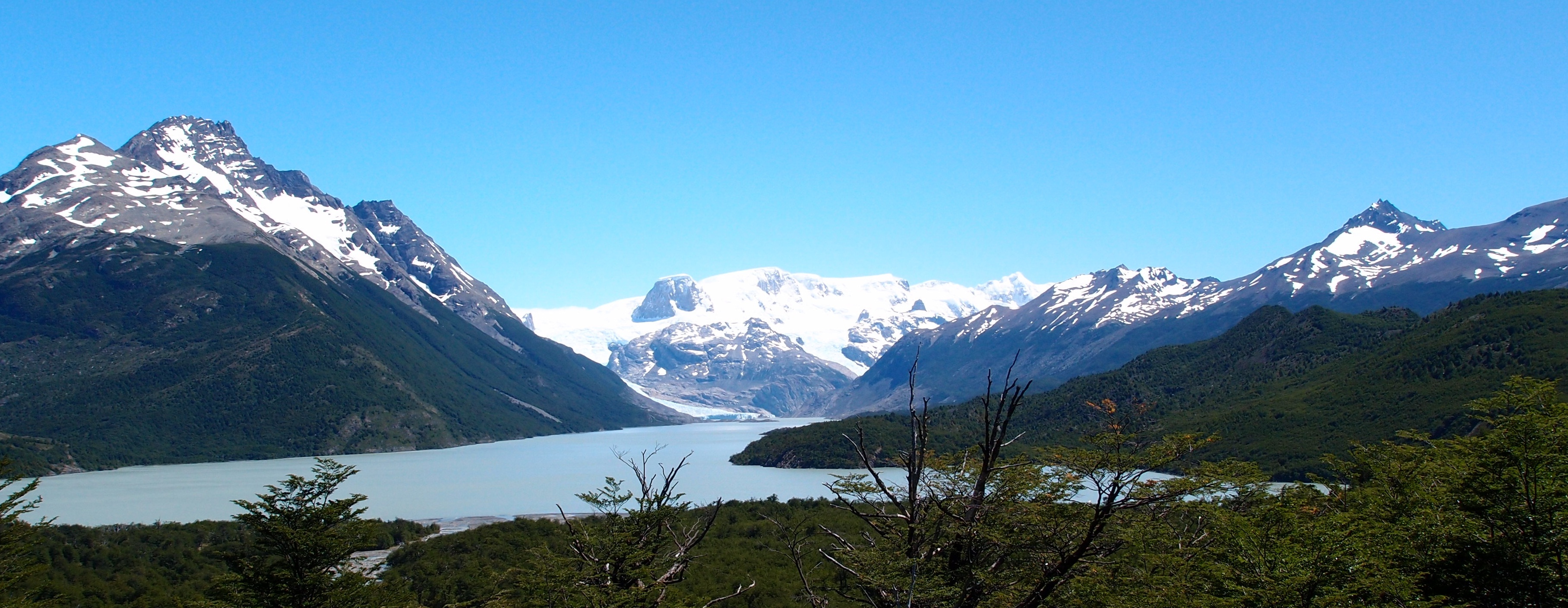
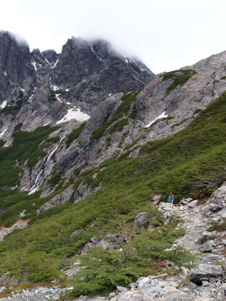
We saw some pretty nice things in our 5 days but nothing which needs explaining, so here are some photos (They are in a higher resolution than usual so click to see them bigger); enjoy!
torres del paine circuit second day between seron and dickson

torres del paine lago dickson refugio

Location of one of the refugios (right next to the lake). The really white thing is a Glacier.

Glacier from a mountain pass

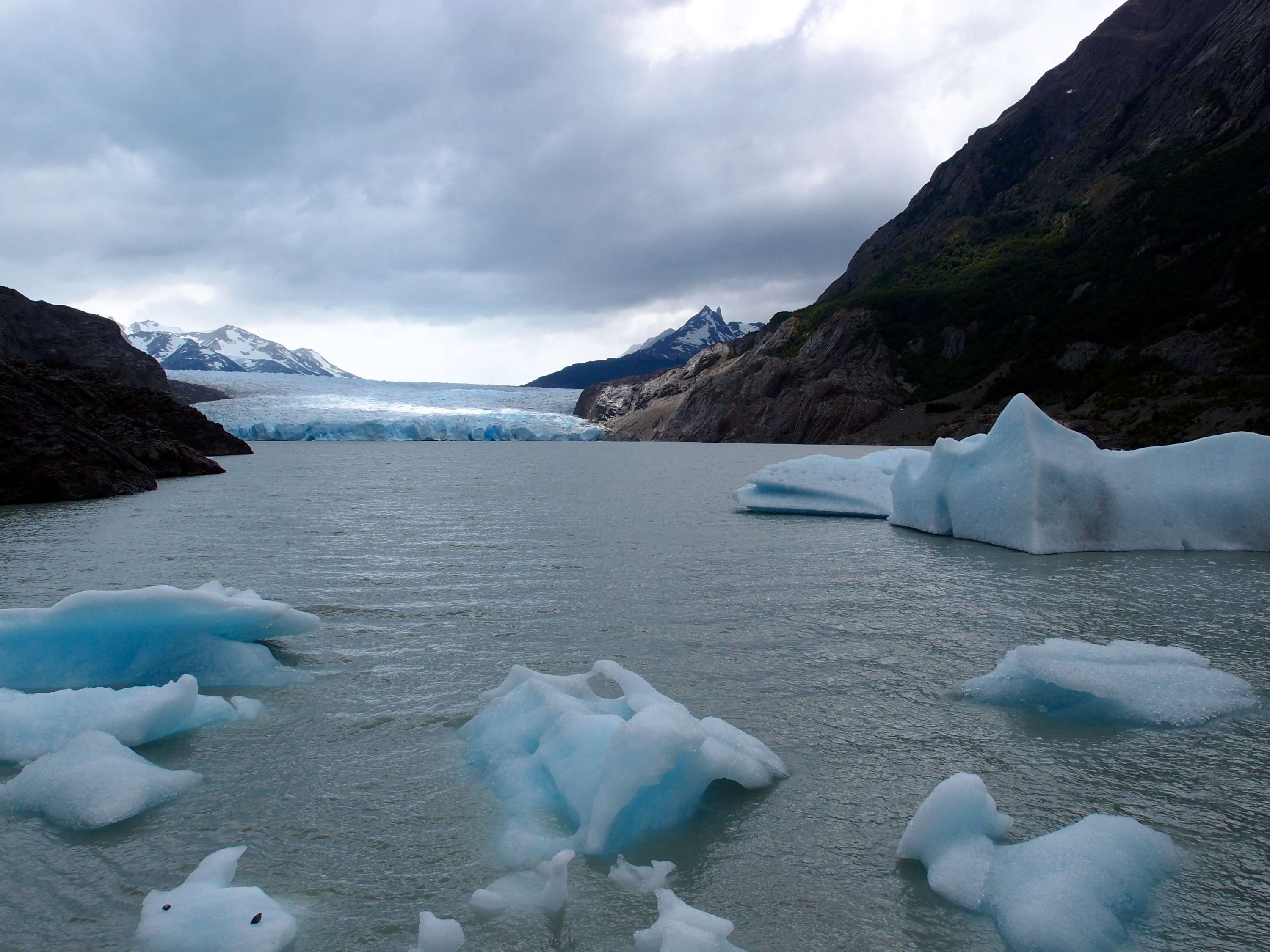
Ice bergs!

The Navimag

Thursday, December 22nd, 2011

We’ve just arrived in Puerto Natales on the Navimag Ferry, which is essentially a cargo ship which runs between Puerto Mont and here. The Navimag Company apparently discovered that this freight route coincided with a leg of the journey taken by many travelers through Patagonia, and, some years back, began the lucrative business of ferrying tourists for $400 per head.

With this history in mind, we certainly weren’t expecting a luxury cruise, but for $400, which is considerably more than the cost of traveling the route the via most other means, we were still expecting… actually, I have no idea what we were expecting. Unfortunately for travelers such as ourselves, It is difficult to form accurate expectations of most things in Patagonia as it is usually almost impossible to find any information anywhere. When we planned to catch the bus to Bariloche, for instance, it was only by chance that another traveler mentioned to us that it had been so seriously effected by the volcano. Wikitravel didn’t mention any of the effects of the volcanic blast on the town, and the only article we could find online was a government travel warning from June (with a note stating that the information still applied at present) declaring that the the city was in a state of emergency, the town was in the process of being evacuated, and that all travel plans to Bariloche should be canceled. This, we discovered for ourselves, had not been the case for some months, and on days with wind blowing in the right direction, the ignorant traveler wouldn’t realise anything had happened there. Internet research on the Navimag proved similarly fruitless. Interestingly, the only personal account of the Navimag we had heard was from a Dutch traveler we met in Santiago. He had taken the Navimag Ferry about 10 years ago, and had woken in the night to find that the ship tilted dramatically to one side, and discovered, on further inspection, that this was because it was in the process of sinking. While this sounds like the sort of story which nightmares are made of, or possibly the inspiration for a horror film; the evacuation, he told us, had been a civilized affair and no one was hurt.

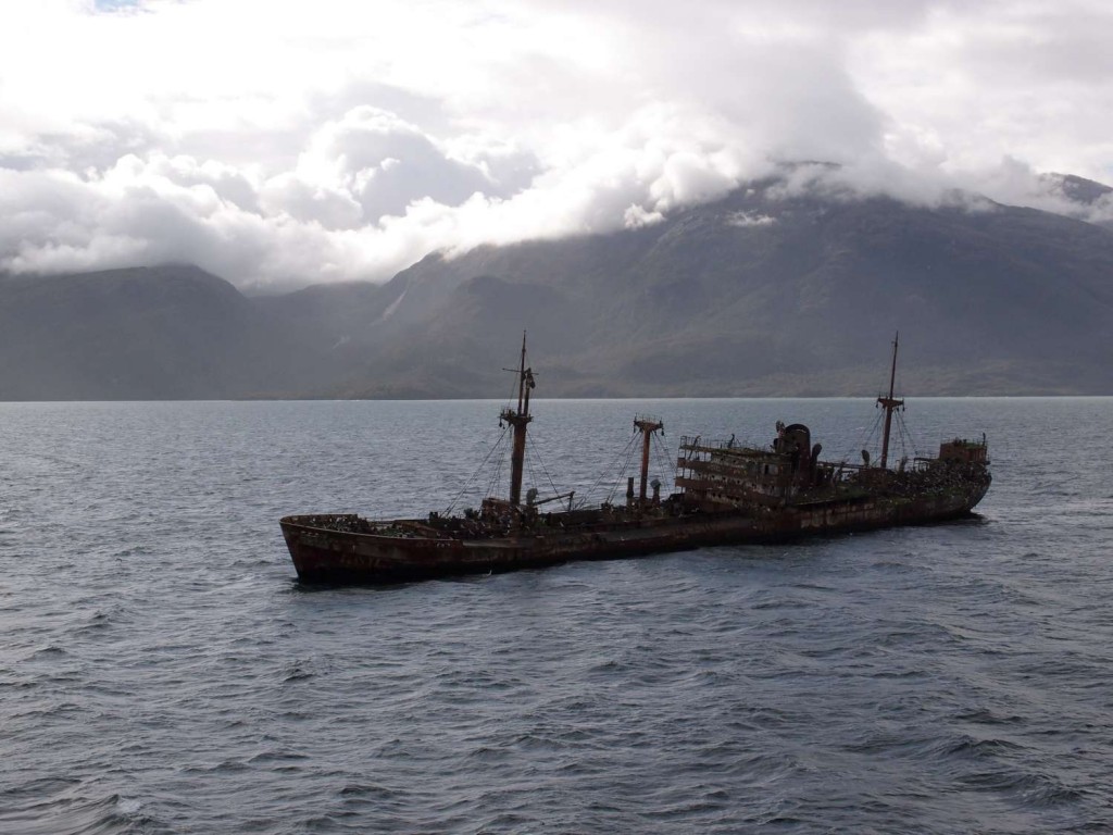
Navimag Shipwreck

Ghost Ship- a wreckage we passed

The boat turned out to be fine in some ways, and really poor in others. There was a nice bar upstairs, which sold drinks for reasonable prices and a TV which screened movies once a day. They played the same mix tape in the bar, over and over and over again which became pretty unbearable after a while. A brief aside: In Chile there are about 20 songs which you’re allowed to play in public, I’m not sure if its a law or just a social convention, but every venue, including the bar on the ship, plays a mix tape with about 7 of these 20 songs. Some examples are: Friday I’m in Love, by The Cure; Never Want to Give you Up, by Rick Astley; Living on a Prayer, by Bon Jovi, and some other song by Rick Astley which is only subtly different from Never Want to Give you Up; it really takes a trained ear to tell the difference between the two (I developed this skill after hearing each song about 7000 time).

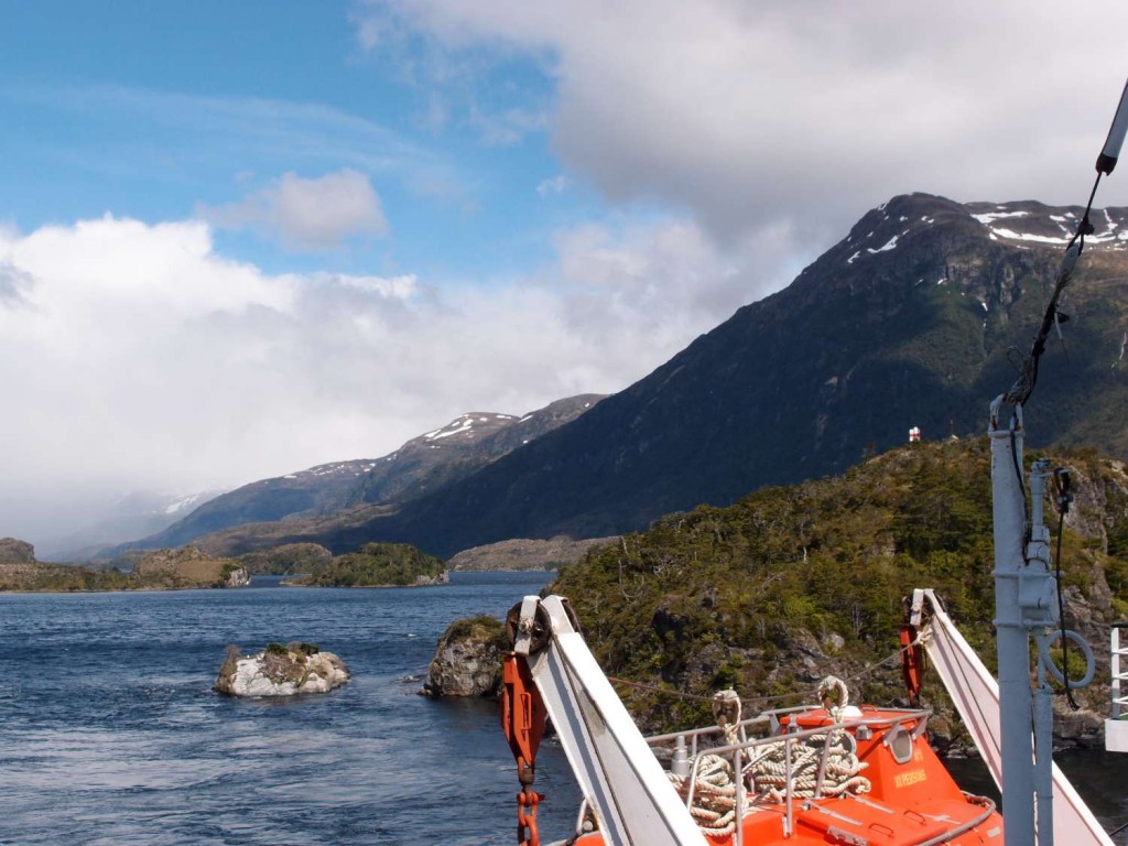
The view from the boat

Below the Bar there was a huge eating hall where all meals were served. They also had lectures there from time to time, covering a wide range of topics, from Chilean flora all the way to Chilean fauna. The guy who took them was this likable and charismatic German guy who unfortunately had such a strong accent it became quite tiring to listen to after a while. Besides the decks, which were always painfully cold (probably to be expected as if the boat were to continue on the same course for another two days it would run aground on Antarctica), that’s pretty much all there was on board. Add to this, a complete communication blackout (no internet, telephones, tv etc) and you have all the ingredients for a really boring four days. Of course if your passions in life are drinking, occasionally watching movies, gazing out a window at Chilean coastline, and chatting with old people, I really recommend you take this boat trip. Otherwise, I’m not so sure its a good idea.

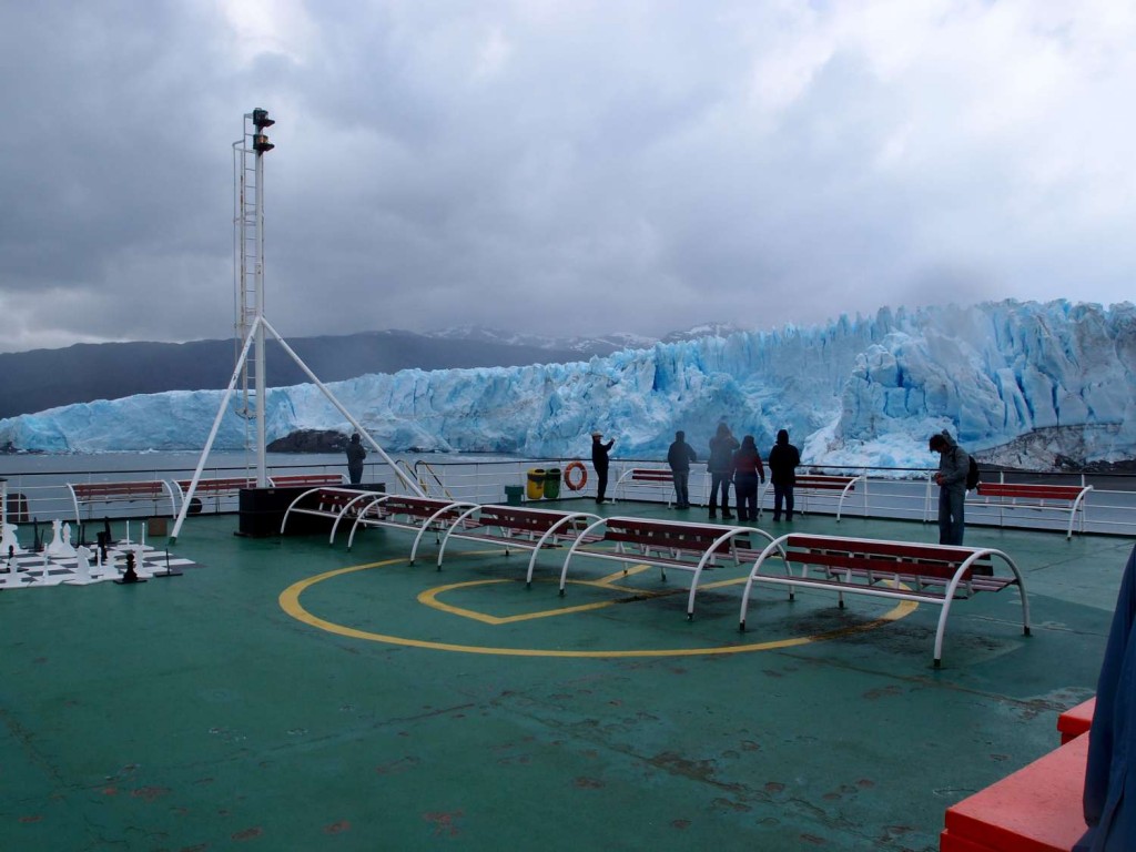
To the trips credit, however, the views from the ship are consistently amazing. The boat goes close to a glacier at one point, and there are heaps whales in the area (even blue whales we were told in broken English at an informative fauna lecture).

Glacier Navimag

Glacier

On the third day as I sat in the corner of the eating hall, experiencing a level of boredom previously unknown to me, I watched a geriatric women peer around to check that no one was watching (didn’t see me apparently), then pour a decorative bowl of cumquats into her backpack and sneak off looking satisfied that her thievery had gone unnoticed. At about this point it hit me in a depressing kind of way that I really didn’t want to be on this boat anymore, and I regretted getting myself onto it.

Nick and Anna claim to have liked the trip though, so maybe my tolerance for boredom is unusually low,but I have my suspicions that Nick just likes any form of transport with dials, little flashing lights and navigation equipment. Still, I can promise you that if I go through some time vortex and wake up in the past with my current memories and have to plan my trip again, I’m taking the bus to Puerto Natales.

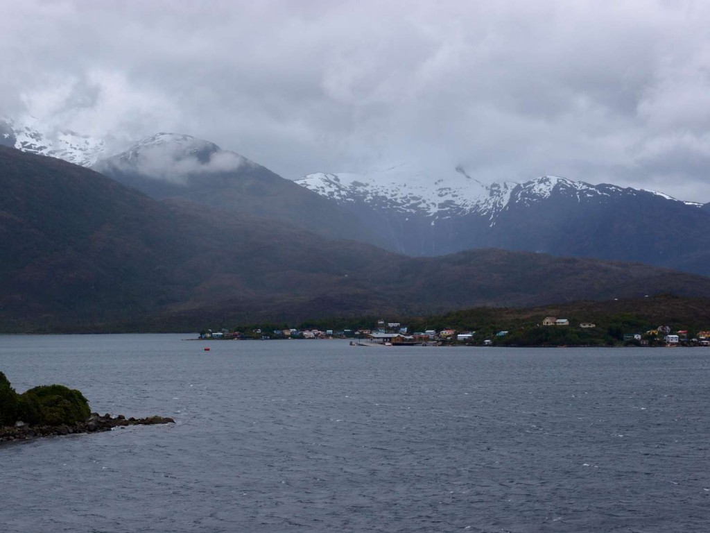
One thing which I’ll admit was really interesting is this town nestled in the mountains which we passed on the way. Its called Puerto Eden and is supposedly the most remote Chilean settlement save a colony on Antarctica. It has no roads and is accessible only by boats which must come from cities hundreds of kilometers away, it also has the highest frequency of rainfall of any place on earth (why anyone would want to live in this place I have no idea). Anyway, there is a race of people called the Kawéshkar of whom there are only 15 pure-blooded remaining, all of which live in this town. Unfortunately they are all men, and pretty old, so if you ever want to meet a Kawéshkari you should probably go to Puerto Eden ASAP.

Puerto Eden

Puerto Eden - The rainiest place in the world and most remote town in chile

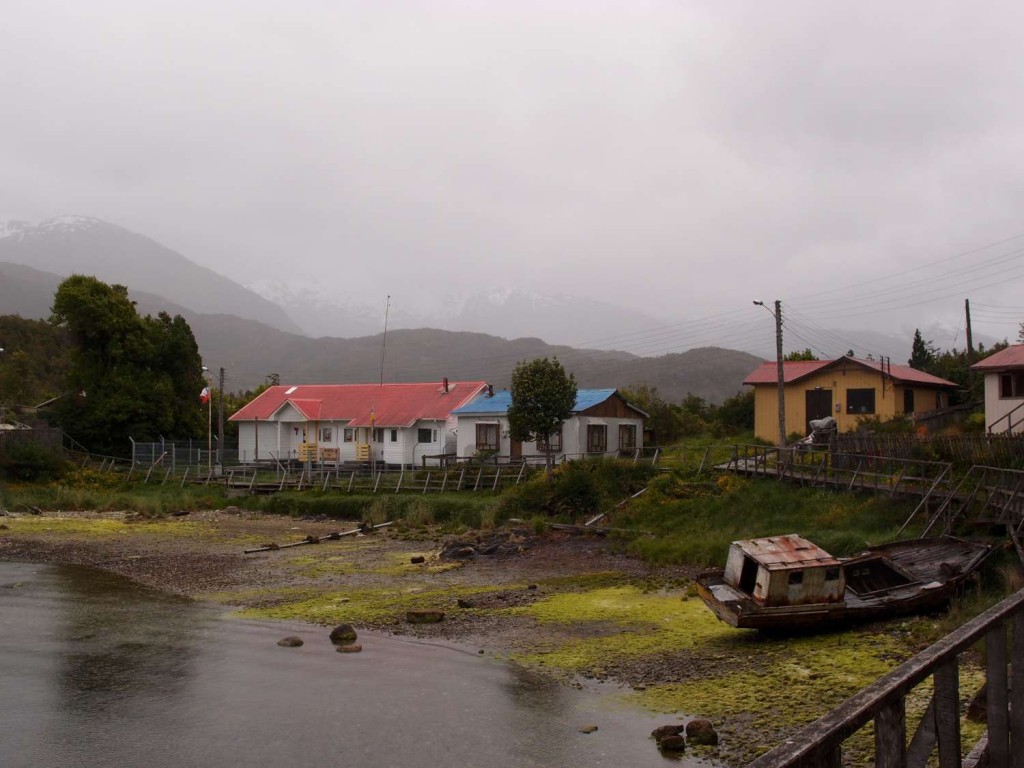
Anna and Nick went on a side trip to walk around the town (unfortunately I was still food poisoned at this point) and said it felt a bit ghostly with mist in the air, and lots of rusty abandoned ships; most of the people obviously stayed indoors or at least their boat. The $10 fee the Navimag tourists pay for the lift ashore is probably the biggest (if not only) source of income for the strange little town.

Puerto Eden

The beautiful bay at Puerto Eden

Shock!

Wednesday, December 14th, 2011

Shock shock shock! New site!

Well, a little different. It took us a whole bottle of Pisco Sour this afternoon to redecorate, so we hope you like it. We’re particularly pleased with the top banner, every time you load the page you will be greeted with a different photo from our trip. Overkill, perhaps, but neat right? The design was hotly debated, so let us know what you think. Suggestions welcome.

We’ve now left Bariloche, and are back in Chile in a town called Pucón. Our last day in Bariloche was spent hiking up to the refugio that we would have reached if we hadn’t chickened out on the terrifying mountain pass. Again, the walk was spectacular. Its amazing the variety of different country around Bariloche. This walk basically followed a river from where it flows into one of Bariloche’s enormous lakes, up to its source, the tranquil Laguna Negra and the snow caps that fill it. It’s beautiful country. Sven said it reminded him of Jurassic Park and I think he’s right – these great big open spaces, low green shrubbery and these colossal snow-capped cliffs with waterfalls tumbling down everywhere you look. Photos never quite capture the sense of height and space, but here were our best attempts:

Walking to Laguna Negra

Walking to Laguna Negra

Refugio Italia

Refugio Italia at Laguna Negra

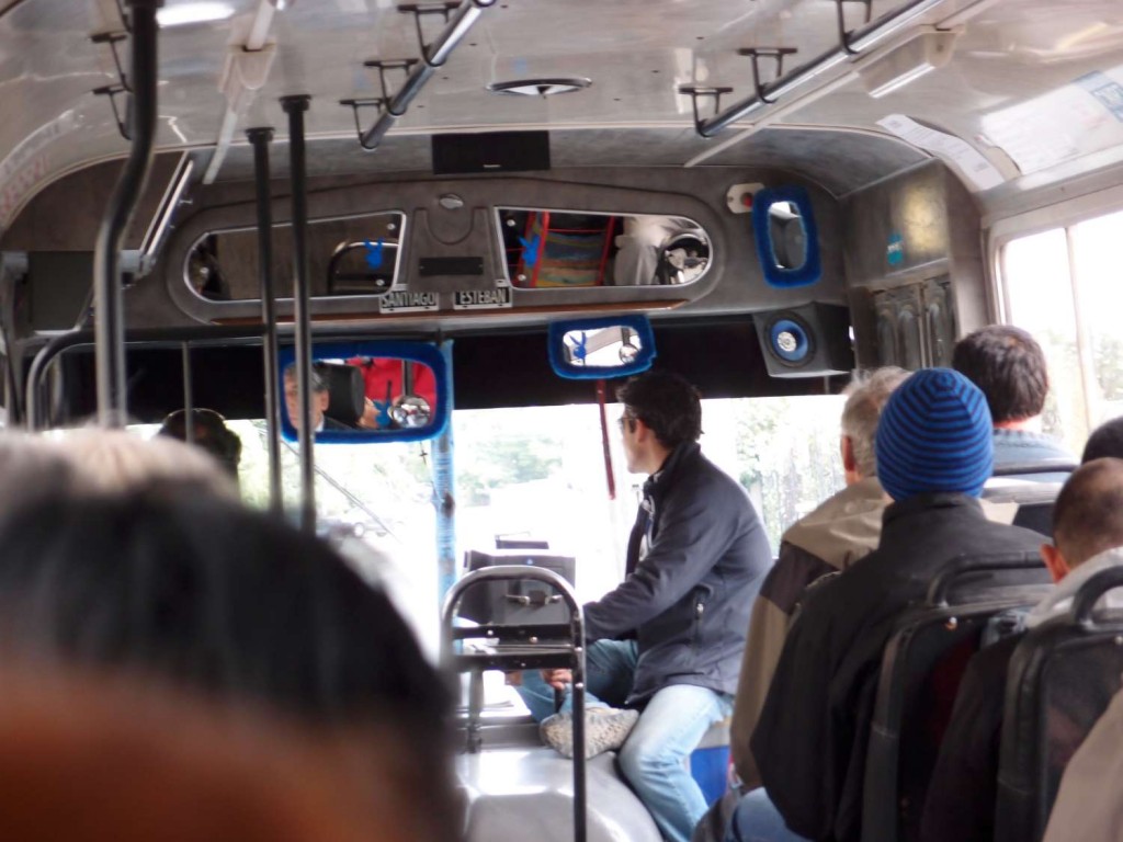
As an interesting aside, the bus that took us to and from the walk was decorated somewhat eccentrically with fluffy blue frames on the mirrors and matching metallic playboy stickers. We’ve been on this route four times now, and each time the driver has been a humourless, aging Argentinian man so I don´t know what that´s about!

Bariloche Route 10

Bariloche Route 10

So that was Bariloche. We are all very glad that we didn’t listen to everybody’s warnings about the ash cloud and went anyway, it has been a major highlight! Pucón, where we are now, is a great little town filled with adventure activities. The ancient lonely planet we were reading at our last hostel described it as the “Queenstown of South America” and so far that seems pretty accurate. The main attraction is its volcano, one of only five in the world with a permanent lava pool which means its smoking continuously. We’ll be climbing up it tomorrow (if I don’t make myself sick from the kilo of raspberries I just bought), so stay tuned!

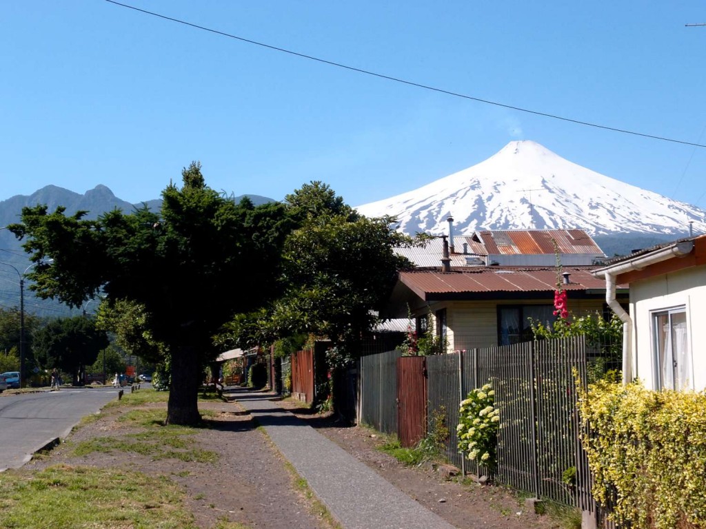
Pucon Volcano

Pucon Volcano

Quitters (especially Anna)

Sunday, December 11th, 2011

Hola amigos!

Just a quick post about our first overnight hike. This is mostly just an excuse to show y’all some of the great photos we’ve taken over the last few days.

The hike which we had planned to do while in Bariloche was closed due to ice, so, on the advice of the guy working at our hostel, we set out for a different nearby hike with virtually no idea of what to expect. The track started near a bizarrely located hotdog stand (maybe 10km from the closest other building), and gradually wound uphill for about a kilometer. Then, all of a sudden, the track seemed to end. Luckily, Nick’s map (and brilliant navigation skills) gave us the general direction so we persevered along some tiny animal trails up a giant hill and into a forest. The uphill didn’t stop for a looonnggg time, sometimes it was more of a climb than a hike, but eventually we made it to a clearing from which we had a pretty impressive view.

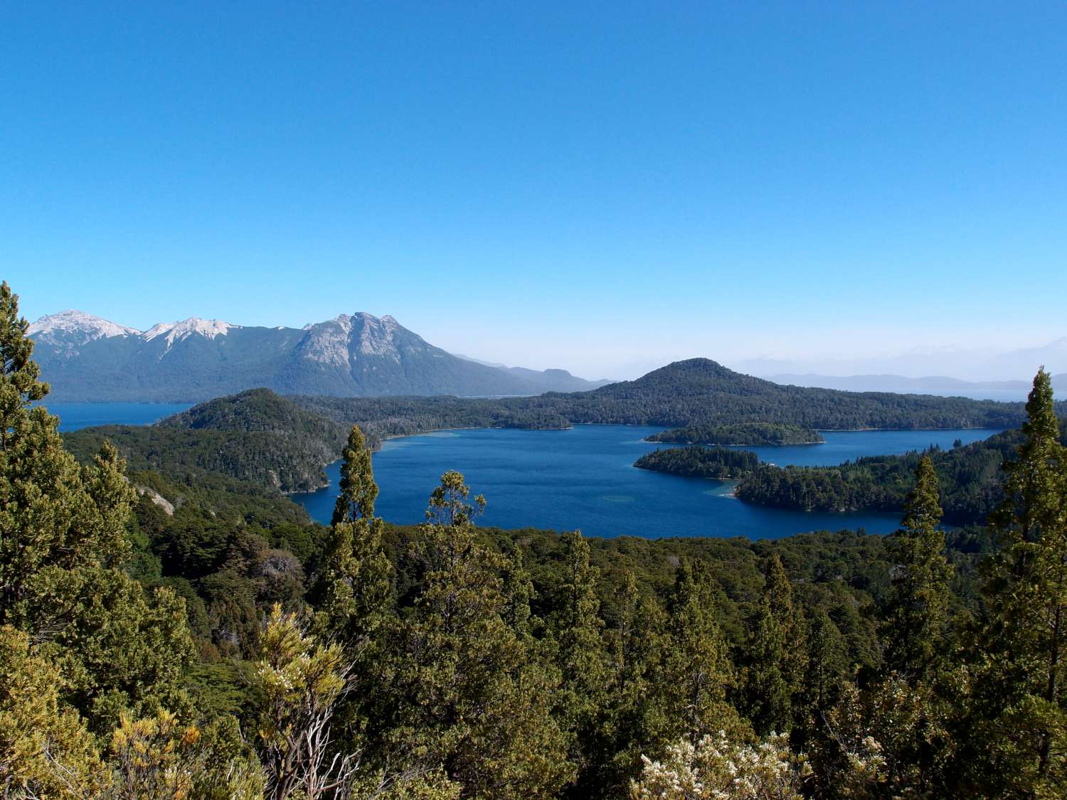
Bariloche Lopez

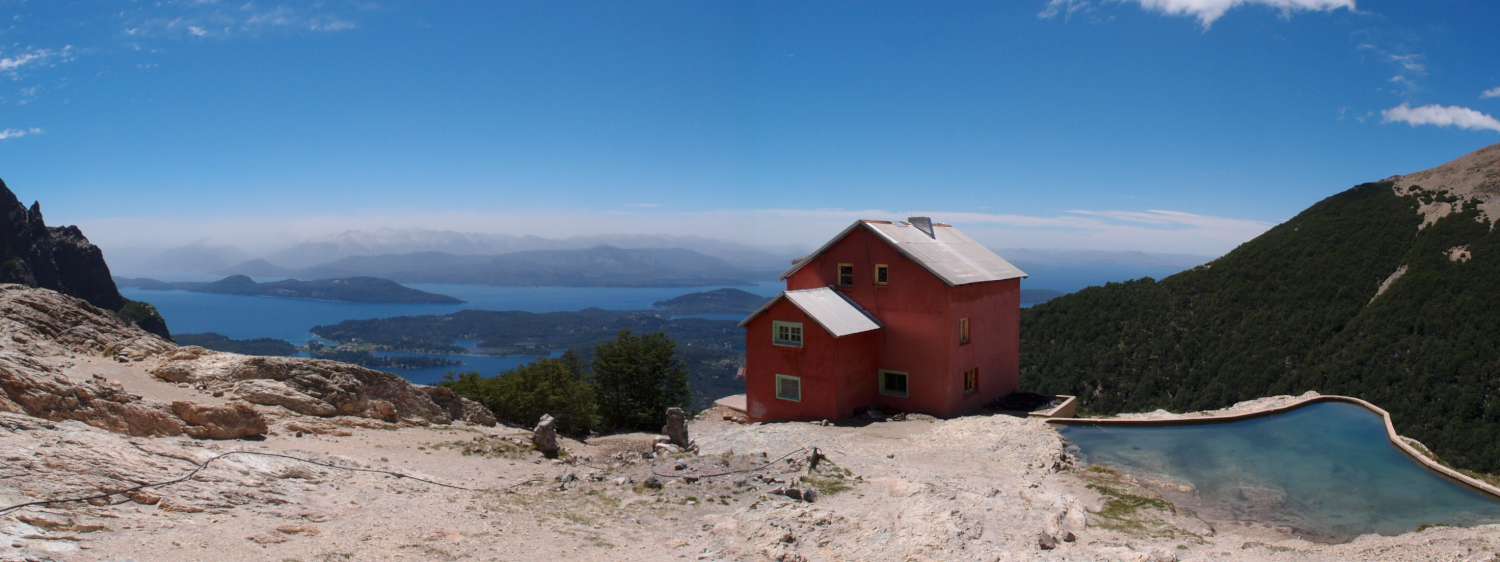
Over the day we climbed from a starting point of about 800m to roughly 2000m, where our hut was, over a distance of only 4 km. For those of you who aren’t familiar with hiking distances and heights etc; this makes for an incredibly difficult walk. The steepness made the views more impressive though, and the hut we stayed in last night is possibly the most spectacularly located building in the world.

Refugio Lopez
Refugio Lopez (the hut)

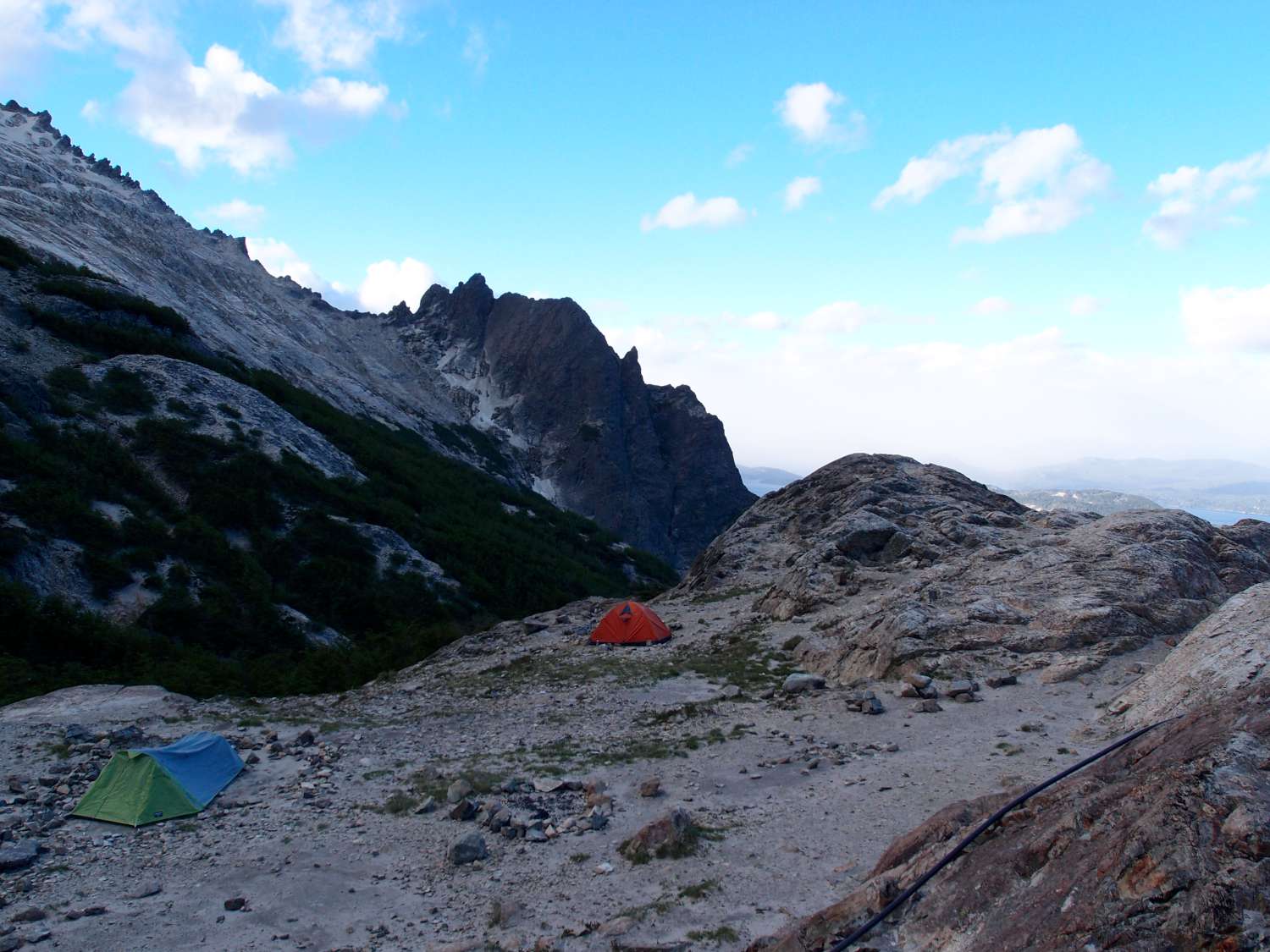
The huts here are great. They have permanent staff (none of whom speak a word of English apparently) from whom one can buy chips, drinks, wine etc. And for about $12 a night they give you a comfortable mattress to sleep on. Anna and I went with this option, but Nick (being the tough mountaineer that he is) decided to camp in the cold and (later) the wet.

Refugio Lopez Camping
Nick´s tent is the closest one

Owing to weirdly timed buses, we had to leave for the hike before 8am, and, as a result, arrived at the hut before 2pm. This gave us a lot of time to look around, so Nick and I went exploring the mountain ridge directly behind our lodging. The mountains jutted about 300-400m above the height of the hut (about the height of Mt Cootha, for those of you who are from Brisbane) and were incredibly steep. We thought we´d try some climbing for fun, but discovered about 100m up, to our horror, red markers up the mountain side indicating the direction of the following day’s hike. Unfortunately we didn’t manage to get any good photos of the mountains, but I will try my best to describe the route up. The majority of the path required hands and feet to get anywhere, and if you looked back you could see maybe 2 m of steep ledge, then nothing until the level of the hut ground 100m below (we pretty much had to walk along the top of a cliff). If we slipped at any point we would certainly plummet to our deaths. I’m not usually scared of heights, and have even dabbled in rock climbing, but I kind of freaked out at this point and had one of those “oh my god i’m actually going to die in the next few minutes” moments, so we climbed back down the mountain.

Refugio Lopez
View of the hut from the terrifying mountain ledge

Because the hike we were doing was evidently far above the level of the regular traveler, the only hikers anywhere near the hut were locals who didn’t speak any English. When we asked if the mountain was, in fact, the path, they would all say ¨si, si¨ and tell us that it was easy. So we discovered at that point that Argentinians are some weird breed of mountain people, because no reasonable person would consider the path easy, or even safe. Eventually a group of five hikers clambered down the mountain from the other side. Four of them were more Argentinians, but luckily one of them was a German guy who spoke English, which was was great because while our Spanish is fine for ordering coffee, it’s not nearly at the level needed to discuss the difficulty of mountain climbing. The German had this crazy laugh which made him sound like a psychopath from a horror movie, but he turned out to be a good guy. He told us that the climb was, in-fact, hellishly difficult, and that once you scaled the first mountain, there were a series of mountain ridges covered in ice to get across. Later that night some Israeli´s came down the mountain looking thoroughly beaten. One had a gash in his leg which was bleeding a lot, from falling down on an ice sheet, he told us. At this point we started to think we might head back the next day.

The next morning it was raining a lot, and even the hut woman told us the pass would be dangerous (when an Argentinian mountain person tells you a pass is dangerous, it must be) so we had a good excuse to turn back without feeling like quitters. So that’s what we did! YEAH TEAM! (So, dear readers, contrary to the name of this post, Anna wasn’t especially responsible for our failings…)

One other thing I wanted to fit in- we think we saw an Andean Condor flying over the hut. ¨Whats so great about seeing an Andean Condor?¨ you might be thinking? Well let me tell you! They are the largest flying animal found anywhere on earth, which is pretty amazing in my opinion. It was pretty far away, so we cant be totally sure that it was a condor, but later the German guy said that he had definitely seen one around the same time, and the thing we saw flying was about the size of a fighter jet, so there’s not a lot else it could have been.

Andes Bird
An example of a bird which is not an Andean Condor. Just another sort of bird of prey which hung around the mountains

Patagonia

Friday, December 9th, 2011

Our first walk through the beautiful Patagonia! This post won’t have much substance and I wish I could put in some narrative flow but I do not posess the writing abilities. They say a picture is worth 1000 words and so I am hoping that this is true in order to make this post worth your while.

Our spirits and expectations of the national parks around Bariloche were dampened when we arrived yesterday to find an ash cloud where Bariloche was meant to be. Despite this we thought it would still be worth it to go for a walk the following day in the mountains and Christine (the Malmorian (i.e. Malmö in Sweden) we have been traveling with recently) had talked to people and basically organised the whole thing for us so we thought we may as well go along. The worst thing we supposed that could happen would be that we may breathe in enough ash to maybe age 20 years.

There must have been favourable winds or something during the night because looking out the window the following morning (before the walk) showed us that actually there was a town beneath of the ash of yesterday and what more there were beautiful mountains as well! At that point we thought that we might actually get to see some real beauty today and maybe only age 10 years instead of 20. With this new level of enthusiasm we hopped on the next bus to the skiing resort town located at Cerro Catedral. The skiing resort was, of course, a ghost town due to it being out of the skiing season (as a side note; this was the first time I have seen skii slopes not covered with snow) but it happens to be where a hike starts. We were only doing a day hike so the plan was to reach the first hut (or refugio as they are called here) of the hike and then come back (10km each way). Unbeknownst to me at the time was that the trail we were walking was one which I had wanted to do while in Patagonia (I was blindly following Christine so I hadn’t bothered to try and work out where we were going).

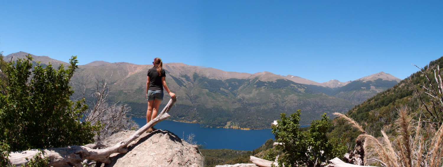
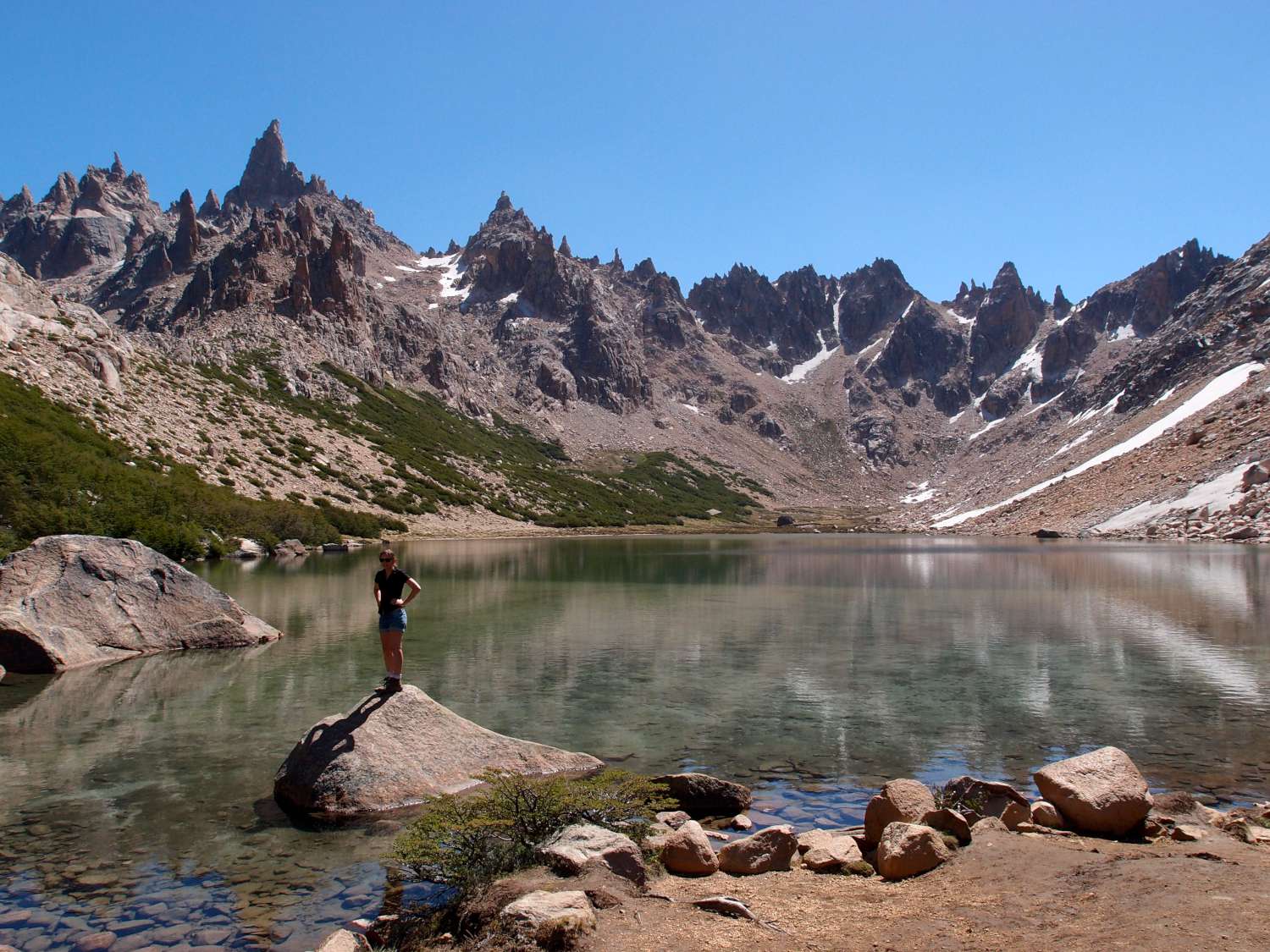
The walk was nothing short of spectactular, photos never give these things justice but they are nice none the less. This section of the Andes, as you will see, is much greener than near Santiago although not nearly as high. It felt very New Zealand-esk.

The theme of these photos is “Anna standing or sitting on a rock”. I assure you it was not intentional, it was just a conicendence that the good sceneriary photos included Anna … on a rock. So if you are a fan of Anna on rocks and nice scenary then get ready for the best darn photos you will ever experience.


Bariloche Frey

Near the beginning of the walk

Bariloche Frey

A river where we stopped to snack.


Bariloche Frey

This was the lake right next to the refugio.


Bariloche Frey

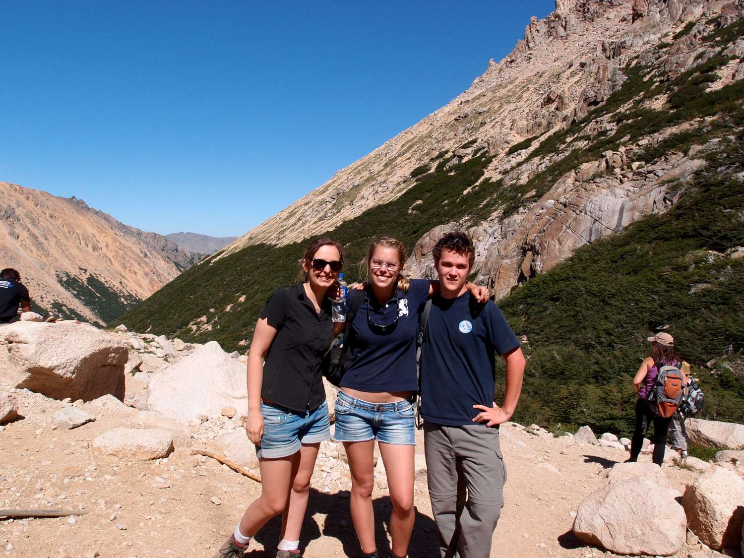
Us at the refugio. The middle one is Christine.

Anyway it was a tiring walk but inspired us to do another in the same area. So tomorrow we depart on a 2 night hike. I’m sure you are all looking forward to that!

Welcome to the real Chile

Monday, November 28th, 2011

So, our first weekend abroad and in Chile… It would have been nice to be able to include Santiagian night life in this introduction to the “real Chile” but a night out for South Americans does not start until 1am (later in other countries) and we have not yet had the energy to commit to such a night. The real Chile I am talking about here is what we experienced on Saturday when we all piled into this guy’s 4×4 and drove for 2 hours east of Santiago. Santiago is so big that it basically took us 1 hour just to get out of the city, then it was just a matter of pointing the car towards the mountains and driving. After a while we entered the Andes and hit a dirt road; the guy driving turned to us and said “Welcome to the real Chile”. We soon stopped at this small mountain town and set off for a walk.

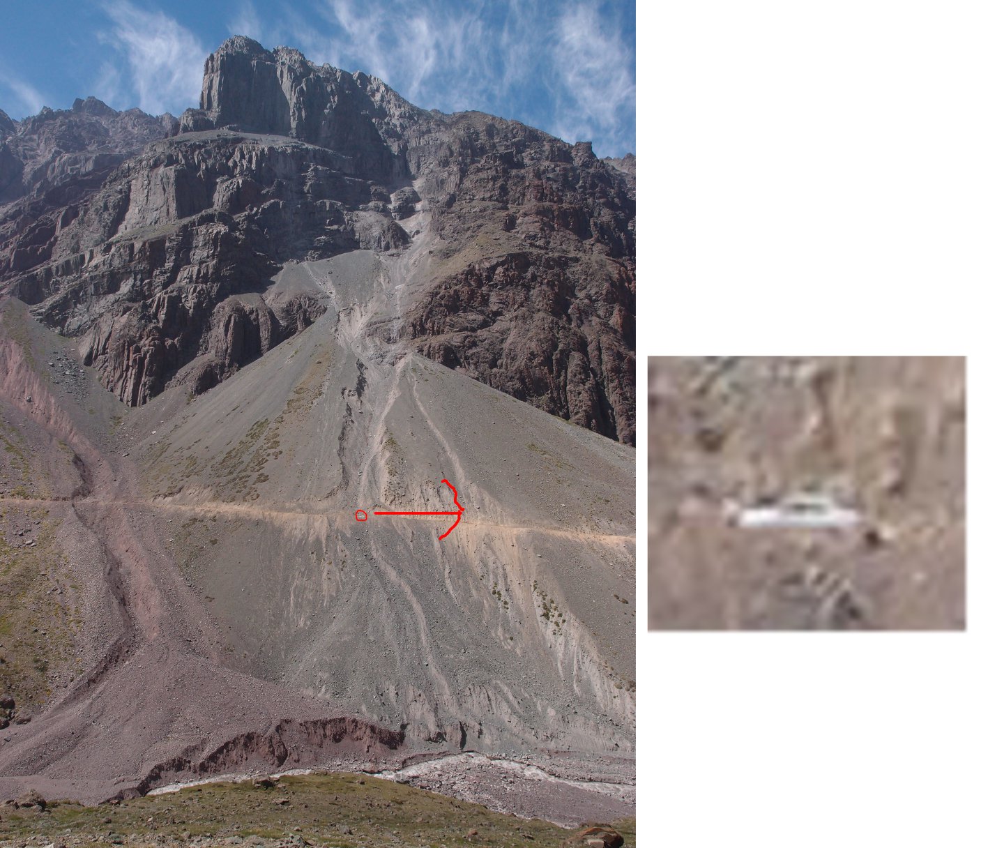
The destination of the walk was pretty vague, just to walk enough of some track to see the tip of the glacier near(ish) to Santiago (the track which leads to the glacier is really long and tough so you basically need horses to get there). Of course the secondary purpose of the walk was to experience the Andes of central Chile. Both of the these things we did; the glacier, while I’m sure is impressive closer up, was not much to see from probably 80 km away, but the miniscule section of the Andes we saw was amazing. Everything in the Andes is on such a perceptually difficult scale. And I’m not just throwing around weird descriptions to sound artistic and “hip”; it is actually hard to take in the sizes and distances of everything. For a small (not very good) example see the photo below; there is a road running along there with a car on it but it is barely noticeable in the photo. You don’t realise just how colossal these mountains are until you get a point of reference like that.


Reference for mountain

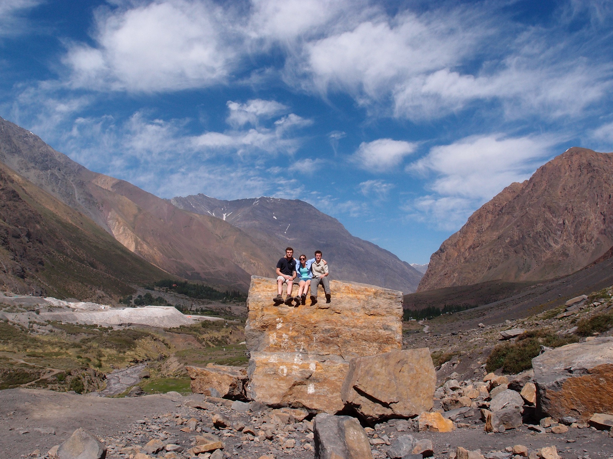
Just for a “Nick, Anna and Sven altitude update”, we were at 2.5km altitude at the end of this walk which is probably the highest all of us have been on land (Mount Kosciuszko – the highest point in Australia- is 2.2km just for reference) and we can look forward to being much higher later on in this trip! (maybe even double!). I thought I may as well throw in a picture of all of us – enjoy!


Us in Los Andes


Arrival & Santiago

Tuesday, November 22nd, 2011

We worked out that time spent in transit summed up to around 24 hours. The flight and time spent in airports was so choc-a-block with adventure and excitment that I dare not write much about it lest my fingers become sore and the keyboard worn down to the bare electronics.

I will mention a couple  of aspects which may be of higher interest. First of all I don’t think I have ever seen a proper rabbi in my life (you know the ones with the hats and the curls on either side of their head) but there must be some jewish conference on (those exist right?) somewhere in South America because during transit in Buenos Aires we saw perhaps 5-10 of them. Whence they had come I suppose I will never know!

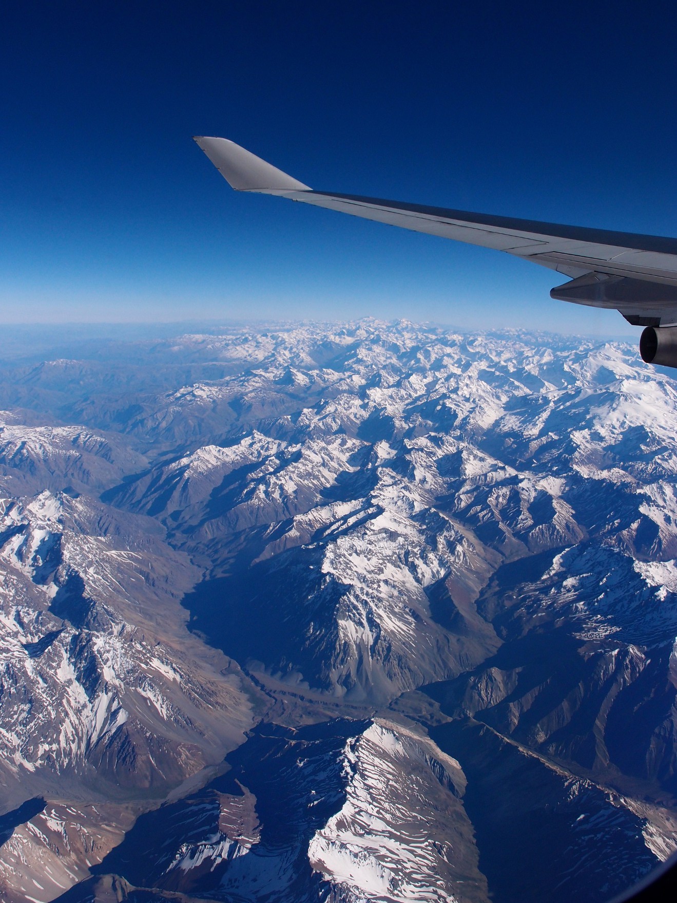
The other interesting event was flying over the andes. The sky was as clear as it could be and we got a nice birds eye view (no bird could actually be as lucky seeing as we were at approx. 11km high) of the mountains. It was a pretty spectactular.


The andes from the plan

We haven’t spent much time in Santiago and the time we did spend was mostly napping. I am sure there will be more comments on it later but as far as first impressions go it is a pretty nice place. Probably by far the safest and cleanest capital city in South America and the constant presence of the andes as a backdrop adds a lot to the city. The photo below probably doesn’t show the best of the place but it is really the only one I took.

Santiago

Oh and the change over in Buenos Aires was really tight so our luggage did not make it. We are hoping that we get them tomorrow morning but I guess we will have to wait and see.

Also let me know if these photos show up too big or too small.